Converting to a shape file allows Deducer to use the latitude and longitude coordinates to plot points on a map.
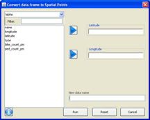
Choose Convert data.frame from the Spatial menu on the menu bar of the Console window. The following window will appear.

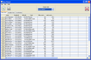
Add the variable containing latitude to the Latitude space and the variable containing longitude to the Longitude space by using the right arrows. Add a name for the new spatial file to the New data name space. Deducer will automatically provide a name if one is not supplied. Click Run. The shape file will appear as a new entry in the pull down menu of the Data Viewer. (The original data remains unchanged.)

Note that the new file has an (sp-p) designation and includes a new tab for mercator coordinates.
Now that you have a shape file, you can create a spatial plot.